By D
In case you missed it..
Thamel
Three Pass Trek – Part 1
As promised in the last post, we will now describe the nitty gritty details of our Nepal trek: the Three Pass Trek (TPT). We completed the TPT in a counter-clockwise loop. We decided to go counter-clockwise because we had read it was the best way to go to avoid altitude sickness. Specifically, if you go clockwise (attempting Renjo La first) you go from sleeping at 10,000 feet to sleeping at 15,000 feet in one day. Whereas when you attempt the trek in the counter-clockwise direction (the way we went), you gradually make your way up to sleeping at 15,000 feet before attempting your first pass (Kongma La). In short, going clockwise increases the risk of altitude sickness. Despite this risk, we encountered quite a few people doing the TPT in the clockwise direction and none appeared worse for the wear, but I was very happy with our choice.
Before I write a book, here are some interesting tidbits to whet your appetite.
- We spent over a week above 15,000 feet starting in Chukung and ending as we came down the last pass – Renjo La. This is to say, we spent an entire week higher than any point in the Lower 48 States. Crazy, right?
- No new elevation personal record (PR). We maxed out at 18,500 or so feet on Kala Pattar. As such, our elevation PR remains Mount Kilimanjaro.
Don’t care much for reading? Here is our experience in video form!
And Now.. The Trek Details
Flight into Lukla
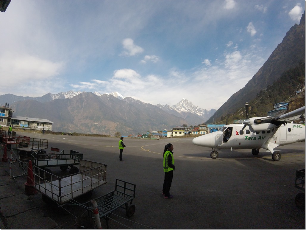
I was anxious for the flight from Kathmandu to Lukla for weeks in advance. If you aren’t familiar with Lukla (or the Tenzing-Hillary airport), it is one of the most dangerous airports in the world. The airport sits at 9,300 ft. The runway is short – 1/10 of the standard length – and has a 12% grade going up as you land (and a 12% grade going down as you take off). At one end of the runway is a 2,000 ft drop into a valley. The other end is a hairpin turn (into the loading zone); beyond the hairpin turn is a stone wall (so you better hope your plane turns!). Only helicopters and “small, fixed-wing, short-takeoff-and-landing aircraft” (read: really small planes, but thanks Wikipedia for the technical term!) are able to use the airport. What all of this boils down to is there is not a lot of room for error. The pilot cannot abort take off or landing if something goes wrong. They’ve got one shot. To add to the physical landing environment, the airport does not have a control tower or any radar or navigation devices. The pilot must depend on what they can see from the plane’s cockpit. Many flights get canceled or delayed into and out of Lukla due to weather, and nearly all of the flights go in the morning when weather is more stable; however, due to the location being in the mountains, weather can change without a moments notice.
Due to all of these factors, the airport has had a few accidents. In 2008, a flight crashed during landing and caught fire, killing 18 people. In 2010, a plane crashed during flight, killing 14 people.
There is an alternate way to reach Lukla. It involves taking an 8 hour bus from Kathmandu to small town (that I can’t remember the name of right now) and then hiking 5-7 days, which would increase your total trek by 10-14 days. We strongly considered this option, but it increased the length of our trek to more time than we had. Plus, we wanted to spend a few days in other parts of Nepal. So, after much back and forth (and freaking out by me), we finally settled on the flight.
In the airport in Kathmandu, we met another (super badass) couple from Colorado doing the Everest Base Camp trek as well as hiking Island Peak. We trekked with them the first day and ended up seeing them several more times throughout our trip. We gave them the nickname C & K because we are so creative. Couples from Colorado rock! You can see C in between us in the above photo, as C & K were sitting behind us in the flight to Lukla. We are excited to meet up with them once we are back in Colorado!
The flight turned out to be a lot less terror inducing than I thought it would be. It was minimally bumpy and the landing was smooth. Ridiculously smooth in fact. Also the views along the way were amazing! We were flying right through “small” mountains, and you could see the snow-capped “big dog” mountains in the distance. Coming in for the landing, you could just see a small runway built into the side of a mountain. And when I say “you could see” I mean you could actually see it since the cockpit was open. It was incredible. Once we landed (alive), I decided it was an amazing experience.
We hiked for a few hours the first day, and stopped at Phakding. Since we started the trek in early March, it was pretty quiet in the towns, and we had our choice of lodges. Most tourists start to come late March and early April. We ended up randomly choosing a lodge, and it turned out to be fantastic. There was a group of monks staying in the same lodge as us, and they spent the whole day playing instruments and chanting in one of the rooms upstairs. Walls in teahouses are notoriously thin so you could hear the music throughout the building. Super cool.
Namche Bazaar
We reached Namche Bazaar on the second day of the trek. Namche Bazaar is the unofficial capital of the Khumbu Valley. It is filled with a mixture of teahouses and bakeries and shops selling trekking gear and Sherpas going about their daily lives and kids playing badminton. The village is built into a bowl which naturally creates levels. It can be a workout just to get from your teahouse to the delicious bakery on one of the lower levels. I love Namche Bazaar. It is surrounded by beautiful mountains, it has bakeries with phenomenal yak cheese pizzas and coffee and baked goods, and it is unpredictable in that you never know who or what is going to come down the stone step path going through town, be it Sherpas on horses, or a train of yaks, or porters carrying 100 lbs on their backs, or members of an Everest expedition.
Slowly Gaining Elevation
The next few days involved a few hours of trekking each day and long afternoons spent in teahouses or exploring the nearby villages if it wasn’t bitterly cold (a con of starting your trek in early March!). We also filled our time by consuming vast quantities of tea, eating at bakeries for as long as our “budget” allowed, and reading and planning out the trek for the next day in the common room while waiting for the stove to be lit. Because we were gaining so much elevation, we didn’t want hike more than a few hours a day to avoid getting altitude sickness. One of the more memorable side treks was hiking to Ama Dablam base camp from Pengboche.
Ama Dablam is a one of the more distinctive mountains in the Khumbu and is also a popular peak to climb. It is NOT a trekking peak, though. It requires a good deal of mountaineering experience and skill (and money). Supposedly, during high season, the base camp is larger than Everest Base Camp. We read this fact and thought, “let’s go see if any expeditions are setting up camp yet!” So off we went. After a little difficulty finding the path we made our way to the base camp (probably a 1.5 hour hike to get there) and found….nothing. No people, no tents, nothing. It was a really cool experience. Just a huge, open field with Ama Dablam towering above it. We had a quick lunch and enjoyed the view (Ama Dablam is the Brad Pitt of mountains) and then headed down.
Throughout this stage of our hike, we definitely could have hiked more quickly or put in more mileage per day, but we really didn’t want to get sick. We decided to take our time and enjoy the acclimatization. Some people went faster and were fine. To each their own.
Chukhung (and Chukhung Ri)
The village of Chukhung sits at around 15,000 ft. There are two major reasons you would stay in Chukhung – if you are hiking Island Peak or doing the TPT. Folks doing Everest Base Camp (EBC) don’t go to Chukhung. It is the first night we spent above 15,000 feet. Also, it was cold. The teahouse already had a fire going around 11am when we got there. We met several awesome people in this lodge including a few Spaniards aiming to do Island Peak, a girl from Canada/NYC doing Island Peak who was travelling for several months similar to us, and two older men from the USA, one of whom who has been in Nepal on and off since the 1970s when he was in the Peace Corps.
Unfortunately, it snowed a bit our first night in Chukhung. I say unfortunately because even small amounts of snow can make following a trail nearly impossible, or at least following the less traveled trails going over the passes. There were a few other people going over the pass that morning, but fortunately for us, we were scheduled for an acclimatization day in Chukhung which involved hiking Chukhung Ri. “Ri” means hill or summit in Nepalese. Even though there was only a little bit of snow, we had a tough time finding the trail up the peak. We ended up traversing the mountain (off trail.. oops), but we eventually linked back up with the trail to the top.
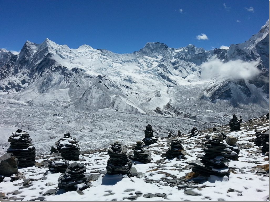
It was a nice (difficult) little climb. There are two peaks at the top. The saddle between them is filled with many cairns (piles of stones usually used to tell people they’re on the trail). It’s pretty cool. We went up to the smaller summit (which is about 17,700 ft). It was a wonderful way to spend an acclimatization morning…with an afternoon filled with milk tea!
The Sickness
WARNING: Only read if you like unpleasant details about getting sick on a mountain.
The night before we left for the first pass, I got exceptionally sick. It was one of the worst nights of my life. Not only was I super sick, I was in a (literally) freezing room with a sleeping bag as my only source for warmth. I had to leave my sleeping bag and enter the freezing cold to go to the common toilet multiple times through the night. But, it wasn’t just an ordinary toilet in a freezing stall, it was a squatty potty. If you aren’t familiar with a squatty potty, it is pretty much how it sounds. It is a ceramic fixture on the ground with ridges to put your feet on. In between the ridges is a hole with water. That is your target. Let me tell you, this kind of fixture can be challenging in the best of times. When you are losing fluids out of two ends, it is downright miserable. If that would have been the extent of it, it would have been bad enough but it was accompanied by burping and flatulence that smelled distinctly of sulfur (read: rotten eggs). The worst of “the sickness” was from 10pm to 7am. We are guessing “the sickness” was caused by some sort of bad bacteria (the sulfuric smell is supposedly an indicator of a bacterial sickness), but who knows what it was. All I know is it was awful and smelly.
First Pass – Kongma La
We had initially wanted to leave for the pass by 7am. Since the passes are at high elevations, you generally want to get an early start to beat any bad weather that may roll in in the afternoon. However, “the sickness” left me weak. By 6:30am, I still couldn’t hold down any food. I started feeling a bit better and was able to keep down plain porridge and hot water by 8am, so we decided to give it a go. It very well could have turned out to be a stupid decision, but I wasn’t in the mood to hang out in the lodge (and with that squatty potty toilet) another day. I decided, if I was going to be sick again, I would rather do it on the mountain than in that toilet.
The path to the pass was fairly easy to follow. When the path wasn’t obvious due to snow, we were able to follow other peoples’ footsteps in the snow or keep an eye out for cairns. We had no idea how people had done this pass the day before with no tracks to follow – it would have been much more difficult. We ended up meeting a few people who had done the pass the previous day at our lodge that night, and it took them almost 11 hours to do the pass. It took us around 6.5 hours. Yikes.
The hike itself was split into several sections. There would be some climbing for awhile, followed by a flat section, then more climbing. Waterfalls and frozen lakes were interspersed. I imagine it would be even more beautiful if they were thawed out. The final climb to the pass was quite steep. I was feeling weak due to being sick the night before and very little sleep. I’m ashamed to admit that Sam carried my bag for the last 100 meters of vertical gain.
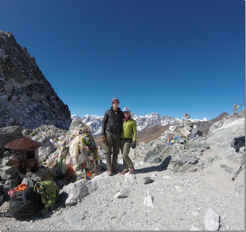
The views from the top were outstanding. Probably the best of the three passes. We hung around for a bit, and met two other people (of the four total we saw during the day). It was a 70 year old man and his guide. Quite impressive to do this trek at his age!
The way down was harder than we anticipated. It consisted of huge boulders, many of which had snow and ice on them – slippery!
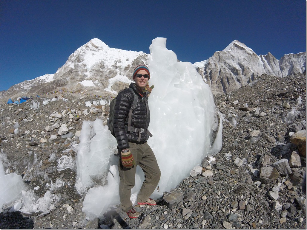
Down, down, down. Finally, we made it to the bottom of the pass and were confronted by a large moraine (pile of rocks left by a glacier). You could see the moraine and the glacier from the top of the pass but it was much larger than we were expecting. Plus, after summiting the pass we assumed the rest of the day was all down hill. Nope. Real jerk move by mother nature. The glacier was fascinating though. It looked like a huge field of boulders and pebbles, but then there would be enormous walls and sheets of ice (and by enormous I mean walls of ice at least 50 feet high). We followed a meandering path on the glacier (marked by cairns) for awhile (with more up and down on already tired legs), before finally heading down the moraine on the opposite side and finishing our day in the village Lobuche.
Kala Pattar
From Lobuche, it’s a short trek to Gorak Shep. Gorak Shep is the “village” (read: collection of a few teahouses) that is the jumping off point for Everest Base Camp and Kala Pattar. It sits at around 17,000 ft and our highest sleeping point on the trek.
Kala Pattar is a hill right next to Gorak Shep. When I say hill, I mean it’s a pretty decent climb that ends at 18,500 ft. People say the best views of Mt. Everest are from the top of Kala Pattar. I’m not sure whether it was the best, but it was beautiful. When we were there, the skies were blue, and Everest was gorgeous. You could see the Khumbu Icefall spilling out of the mountain as well as the Khumbu Glacier stretching down the valley. You could even see the South Summit (a point near the top of Everest well-known to Everest climbers (and enthusiasts, like us!)).
Everest Base Camp
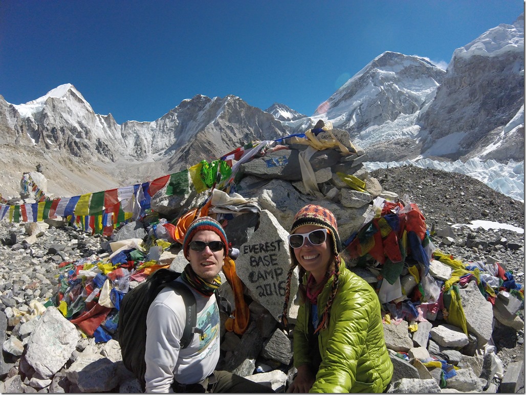
Everest Base Camp is just plain cool. Contrary to popular belief, you cannot see Everest from Everest Base Camp. It is hidden from view. However, you can see the magnificent Khumbu Icefall up close and personal. The Khumbu Icefall, as its name suggests, is the glacier equivalent of a waterfall. As the Khumbu Glacier comes off of Mount Everest/Lohtse and makes its way into the Khumbu Valley, it has to lose a lot of elevation very quickly. In the process, the ice sheet breaks apart creating huge crevasses and large solitary ice structures. You know, just huge chunks of ice making their way down the mountain. It’s amazing. Also worth noting, the entire base camp is located on the Khumbu glacier. We knew about this beforehand, but being there in person drove home the point even more – these people are camping on a slowly moving river of ice for weeks on end.
We also saw all the preparations made by those getting ready to climb Everest which was beyond cool. When we were there, the “Icefall Doctors” were setting the path up the Khumbu Icefall. As you can imagine, this is a dangerous section of the Everest ascent due to the huge ice structures. They can move or fall at any moment, killing climbers in the process. For this reason, there is a process in place where a team of experienced Sherpas set a route through the icefall in advance to try to remove some of the danger of climbing through it. They try to make a safe route (safe being a relative term here) by setting fixed rope and building paths across crevasses (which really means locking down ladders across crevasses on which climbers can walk across). The Sherpas who work on Everest are such an amazing and undervalued group of individuals. I could have just sat and watched them work for hours, but we had to continue trekking.
Also, on the way to the camp, we saw a ridiculous number of yak trains. A yak train is exactly as it sounds… a long line of yaks. These animals carry much of the equipment and supplies for Everest expeditions into base camp. They are really cool to watch for about five minutes. After five minutes they become annoying because you have to stop to let them pass if they are going in the opposite direction (nothing good has ever come from trying to squeeze by a yak on a narrow trail), and it is really difficult to pass them from behind.
Path from Lobuche to Dzonghla
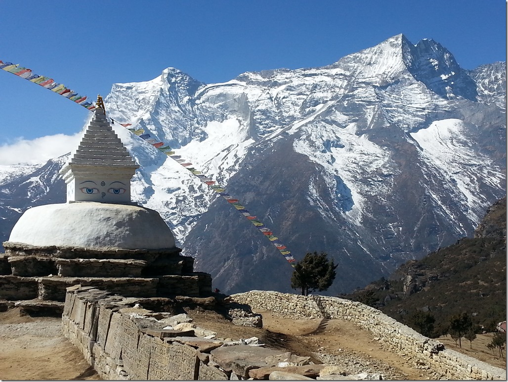
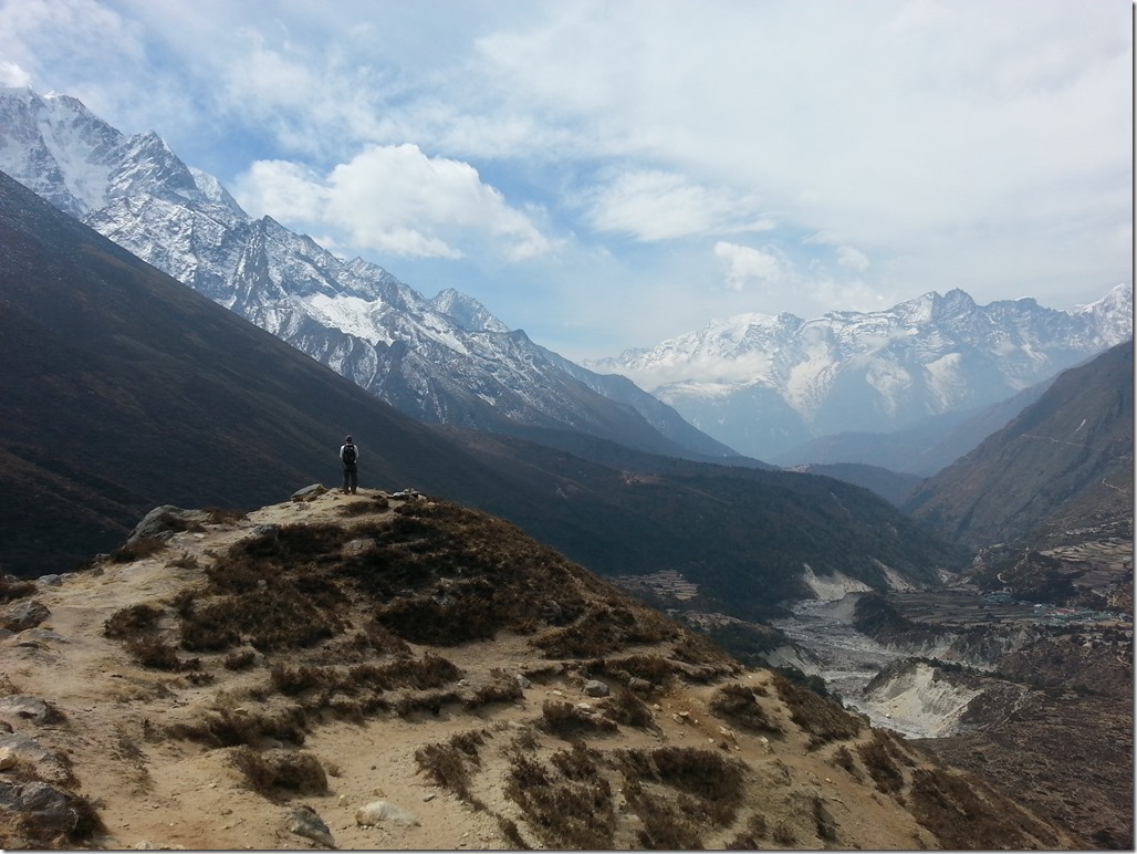
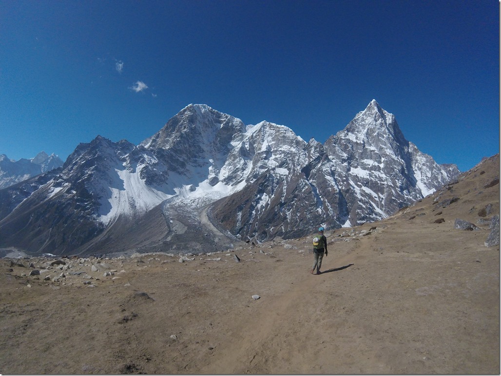
After seeing Everest Base Camp, it was time for us to make our way to pass number two. The path from Lobuche to Dzonghla was one of my favorite sections of the entire trek. The path went down the valley from Lobuche until it met another valley and then turned right (away from the EBC trail) and went up this valley to the small village of Dzonghla. Most of the path was high above the valley floor along an open, gentle ridge. There were no trees to block your view and the scenery was incredible. On the other side of the valley were three huge mountains. I could look up the names of these peaks, but I’m too lazy. They were so close you felt like you could reach out and touch them. There are amazing mountain views in most places here, but this particular scene sticks in my mind. In Dzonghla, the views were similar, with the mountains right outside the window. I pretty much just sat in the teahouse and looked at them all day.
Second Pass – Cho La
Cho La was my favorite pass for a few reasons.
- Boulder Field: There is a huge uphill section of climbing over boulders to the pass. It is hard, but really fun. If you like scrambling over boulders, that is.
- Glacier: Near the top, there is a huge glacier. But not the kind we’ve described previously that are full of rocks. It’s more what you envision a glacier as: white and icy. We trekked on and over this and it was awesome! We sure were glad to have our microspikes at this point, though. It was slippery (go figure, I know)!
- Scrambling: Just near the top, there is a tiny section of some pretty difficult (for the elevation and with your pack on!) scrambling. Like, literally just 20 feet below the top of the pass. It was so fun though! I definitely had to use my hands. I’m all about being hands on!
Compared with Kongma La, however, the view from the top wasn’t quite as good. The descent off the pass was similar in that it was steep and rocky. Also similar to Kongma La, we had to cross another glacier (read: a wasteland of gray rocks) to finish the trek. However, this glacier, the Ngozumba glacier, was (or at least seemed) bigger than the first one. The path across the glacier was really easy to follow once you found where it started. One important note – the path across the glacier is further north than the path shown on our map. My guess is that they recently changed the path and the map has not been updated. Just head north out of Dragnag and you’ll find the path.

Sometimes it was hard to imagine we were crossing a glacier with all of the huge rocks we were walking on.
The trail over this pass was a bit more difficult to follow, but there was green paint on many rocks indicating the way. Maybe not the most environmental solution, but we were thankful. It took us about 7 hours from lodge to lodge, with 5.5 hours of trekking and 1.5 hours for lunch.
Gokyo and Gokyo Ri
Gokyo is one of the other big villages in the Khumbu. It is also where we had a scheduled rest day after Cho La and before our final pass, Renjo La. Gokyo is a popular alternative to the EBC trek in the Everest Region. As such, it is more developed than many of the other villages we stayed in. If Namche Bazaar is Denver, Gokyo is Colorado Springs. It has several teahouses (including a few that are a bit higher end), a bakery, and a few small shops. Next to Gokyo is a hill called Gokyo Ri. It is the culminating point of the trek for those just doing Gokyo, similar to how Kala Pattar is the culminating point on the EBC trek on the other side of the valley.
Gokyo is also popular because it sits on a lake of brilliantly blue water. Unfortunately, most of that water was frozen when we were there. There is a chain of several lakes (five or six I think) stretching out from Gokyo that also make for popular hiking trips.
We took advantage of our rest day in Gokyo to hike up Gokyo Ri. It is about 2,000 feet straight up to the top of a hill. It was a great physical challenge. Sam and I managed it in about 75 minutes (although he could have gone faster without this ball and chain!). I know I’m getting repetitive.. but the views from the top. Holy. This was actually my favorite view of Everest. There is also a stunning view of Cho Oyu (the 6th highest mountain in the world) and the Ngozumba glacier. Mountains on mountains on mountains!

The view from Gokyo Ri.. that tiny speck of blue is the part of the lake that has melted right on Gokyo’s shore.
Our plan had scheduled two rest days in Gokyo, but we were getting antsy to be done trekking. Don’t get me wrong, I love the mountains, but we were tired of being cold. Plus, it’s not cheap to be up high in the mountains (see: food), and the lack of showering and access to the outside world was starting to get to us. So, we decided to tackle the next pass a day early.
Third Pass – Renjo La
We were a little bit fatigued starting the third pass so we took it slow. The first hour is pretty gradual and easy. The path worked its way along Gokyo lake which was a nice way to warm up. There were a bunch of snowcocks along the path. Snowcocks are hilarious Himalayan birds. Hilarious because they look like the prototype for the bird in Angry Birds (except not red) and they make a strange clucking sound when you get too close. We were big fans. I don’t think they cared much for us though.
The view back to Gokyo and the frozen lake was beautiful. I can only imagine how beautiful it is when the lake is thawed out and completely blue. The next hour or so was steep until it opened up near the top of the pass into a huge bowl. This was portion of the trek where we had the hardest time finding the path. There was one couple in front of us, so we were able to follow their tracks (for better or worse) some of the time. The most frustrating part was the wind. It was viciously windy (which made it seem more cold) and it seemed to change direction constantly (probably because we were in a bowl?). It was miserable. Eventually, we found the final (very steep) switchbacks up to the pass. The pass had gorgeous views of Everest and Lohtse, so we forgave it for being a jerk.
The backside of the pass had a long set of rock steps. Literally steps down the backside of the mountain. It was the easiest descent we’ve had. Eventually the path leveled out and the wind stopped.
We ended up in a grassy valley with huge mountains at one end. That valley joined up with another valley full of sand (interesting right?), frozen lakes, and huge boulders, with gorgeous mountains in the background. We walked through a few towns made up almost entirely of potato farms – stone houses and plots of dirt surrounded by walls of rocks. We also started seeing more evidence of the earthquake on this day. There were wide swaths of riverbank washed away and huge boulders sitting precariously on the edges of cliffs. We finally made it to Thame (a town hit very badly by the earthquake) but it seemed to have recovered well. We spent one night in Thame, and then headed back down to Namche Bazaar.
Overall, Gokyo to Thame via Renjo La was one of our favorite days of trekking (albeit very long). The views were amazing, the trail was nice, and we only saw two groups of people all day. The towns in this valley did not cater to trekkers like those on the EBC path so it felt like we were seeing how most of the Sherpa people live.
Back to Lukla
After a night in Namche Bazaar, where we could shower and fill ourselves full of yak pizza and baked goods, we quickly made our way back to Lukla. On our second trip through Namche, we realized how big of a ‘city’ it is for this area. When we first came through we thought it was a quaint little mountain town, but on the way back we were like, “look at all of these buildings! This place is HUGE!” Funny how a few weeks in the mountains can change your perspective.
On the hike down from Namche to Lukla, we noticed the mountain was getting busier! The number of people heading UP when we were heading DOWN was eye-opening. We had heard things get busier in April, and it definitely appeared that way. Although I was tired of being cold by the end of our trek, I’m really glad we went when we did. Having the trails to ourselves (or at least not being in a conga line) and never having to hurry to find an open guesthouse was wonderful.
We got back to Lukla and changed our flight to the following day. Then, we enjoyed what Lukla had to offer, which, surprisingly, is quite a lot compared to what we thought when we flew in. It’s actually a decent sized town. There was a little bit of street food (and it was delicious). There were tons of kids playing on the streets. Life was happening here, not just trekkers passing through a tourist town.
We really enjoyed the last night. Our “teahouse” (it was much more like a guesthouse now) played throwback tunes all night, and we just jammed out and reminisced on our trip. I was not as nearly nervous for the flight out of Lukla (hey, the hard part was over, right?), but was still grateful to land in Kathmandu without a hitch.
Until next time, you beautiful mountains you. And there will be a next time.












[…] In case you missed it.. Thamel Three Pass Trek – Part 2 […]
LikeLiked by 1 person
[…] case you missed it.. Three Pass Trek – Part 1 Three Pass Trek – […]
LikeLike
[…] Source: Trekking in the Everest Region | Three Pass Trek – Part 2 […]
LikeLike